NASA satellites are important instruments that allow scientists to study space. It also provides a view of the Earth including the environmental changes that occur.
The new time-lapse released by NASA shows Earth as it breathes. The collection of images show the Earth constantly changes over a 20-year period.
Using satellite imagery, NASA's Goddard Space Flight Center programmer Alex Kekesi, shared that completing the visualization took three months.
Earth: The Living Planet
"These are incredibly evocative visualizations of our living planet," said NASA oceanographer Gene Carl Feldman. "That is it breathing every single day, changing with the seasons, responding to the Sun, to the changing winds, ocean currents and temperatures."
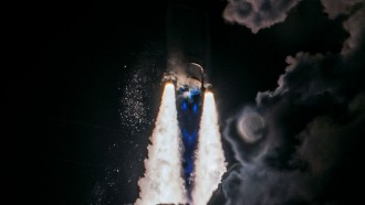
In 1997, after the launch of the Sea-viewing Wide Field-of-View Sensor (SeaWiFS), NASA started recording the Earth's physical properties and activities in both land and water, particularly how it is able to support life. The result of this 20-year data collection and recording through the eyes of multiple satellites is a fascinating animation showing the ecosystems change depending on the season.
The satellite data provided vital information to help scientists monitor changes in vegetation. The data set showed that as much as 50 percent of the photosynthesis happens in the land, with the remaining half occurs in the oceans. During spring and summer, carbon levels remain low because plants produce more oxygen and consume more carbon dioxide.
Colder months, on the other hand, show higher levels of carbon as plants become dormant. Scientists also noticed extreme zones in the ocean, where phytoplankton populations are either non-existent or occurring at high concentrations. Once phytoplankton changes, the entire ecosystem will undergo changes as well.
Although Earth has an incredible biodiversity of plants and animals, scientists believe that studying plants is crucial, not only in understanding the ecosystem but also in predicting possible changes that may occur in the future.
Response To Climate Change
All this data can help scientists predict areas where crops are more likely to thrive and suffer. Farmers can get reliable information about their crops, enabling them to cope with the constant changes in the ecosystem.
As the agency enters its third decade of global study, their present findings can help them come up with strategies and recommendations to help the government and stakeholders in policy-making.
Scientists are looking forward to better visualizations in the future as they would employ newer remote-sensing satellites and undertake more observations to provide a fascinating information about the Earth as it constantly changes over time.
View the time-lapse below: