Earth is not enough for Google. The Internet search company is partnering with NASA to deliver its 3D mapping technology, which was launched two months ago for Android smartphones with 3D sensors, to space for astronauts to use on the International Space Station.
Project Tango, as it is dubbed, will use robots to deliver the new technology and could help to better map, literally, locations that are out of this world.
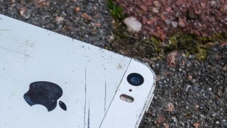
It sounds simple enough: A 5-inch smartphone connected to a 3D-tracking and mapping program through a camera can now be attached to a robotic platform, or NASA Spheres, so users can navigate around the space station. The spheres are satellites about the size of bowling balls.
According to NASA, the robots will be able to work in zero-gravity and would be controlled by the astronauts on board the station. It could help improve safety concerns about space walks and longer distances from the station.
Researchers published a video on YouTube.com that detailed how the new technology would be used and they were expressively excited about the partnership and the opportunities that lay in the future for space exploration.
"Think about having a free-flying robot that can fly around inside a space station, perhaps equipped with some type of future smartphone," Zach Moratto, a research engineer at the NASA Ames Research Center, said in the video that gave details on the project.
"The 3D-tracking and mapping capabilities of Project Tango would allow Spheres to reconstruct a 3D-map of the space station and, for the first time in history, enable autonomous navigation of a floating robotic platform 230 miles above the surface of the earth," adds a Google+ blog post.
Although Google did not deliver a specific launch date for the 3D mapping technology to be used in the field, it is believed that NASA and Google hope to have the project off the ground sometime this summer.
It signals the Mountain View, Calif.-based company's continued efforts in robotics, which have seen a boost in recent years as other companies take aim at similar endeavors using drones to deliver mapping technology to places on the globe hard to access or using mobile robots to have Wi-Fi signals reach remote villages and towns currently off the Internet grid.
The partnership with NASA should allow the space program to get a boost in terms of ability to map new areas and see new regions of space and the planet.
