The submarine robot, Icefin, was dropped in a 700-meter deep ice hole through the efforts of the MELT Project scientists assigned in the Thwaites Glacier in Antarctica. This historic event was video recorded through the efforts of the people behind the project. The footage taken from the robot's expedition captured the grounding line of the glacier.
The grounding line of the glacier is the border where the ice touches land. It is the place where the warm water from the oceans may be melting the base of the glacier slowly. This situation puts the glaciers at risk of collapsing.
What did the MELT Project's Icefin Discover?
The scientists stayed in Antarctica, where living conditions were difficult, for approximately two months and endured stormy weather and low temperatures, reaching -30 Degrees Celsius. In there, they punctured a hole in the ice and sent a submarine robot to reach the bottom part of the ice where water is possibly flowing.
The robot had successfully reached more than a kilometer towards the grounding line, which is a rocky area that serves as the support mechanism of the big ice that floats in Antarctica. The researchers equipped the submarine robot with chemical sensors, portable camera equipment, and other types of tools necessary for studying the situation in Thwaite Glaciers.
The researchers are still reviewing the data that they gathered from their expedition. They are fearing for the possible threats of the warm water coming from the ocean. This water is feared to cause the collapse of the ice on the surface.
Icefin: The Robotic Submarine
In an article from Livescience, Icefin robots were described to bear a torpedo shape-like structure. It had explored Antarctica's biggest glaciers and identified the reason for its rapid melting, and used tools to monitor the sea level on the glacier's lower floor area. Apart from that, the Icefin can measure the water's salinity, oxygen content, temperature, and the manner of water flow.
In previous studies, this technology was used to observe the wildlife in the sea under the Ross Sea in Antarctica.
MELT and the Group In-Charge of the Expedition
MELT is one of its eight primary projects based on the Thwaites Glacier and included in the International Thwaites Glacier Collaboration Program (ITGC), which is a multi-party collaboration between the United States of America and the United Kingdom. The program consisted of scientists from different countries.
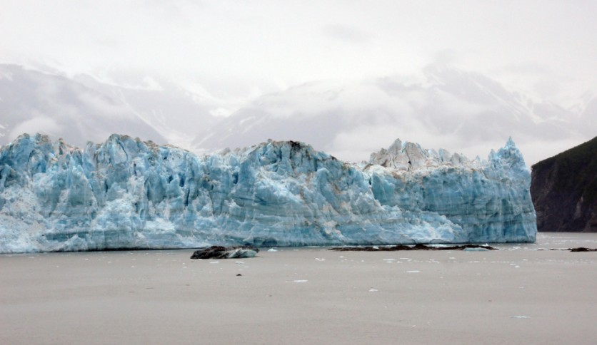
What is the Thwaites Glacier?
The Thwaites Glacier is approximately 74,000 square miles-the land area of the glacier is more massive than Florida. However, it is among the fastest-melting ones on the planet, as about 595 billion tons had already melted since 1980.
Based on the observations of scientists, the glacier's melting speed had increased, while they were on Icefin expedition to determine the reason for this phenomenon.
The group also revealed other glaciers would be affected by the fast melting of the Thwaites Glacier. It will also result in a rise in sea level to 6 feet. According to the director of the program, Paul Cutler, the fast melting of the Thwaites glacier, is believed to be a triggering factor to the fusion of nearby glaciers.
ⓒ 2026 TECHTIMES.com All rights reserved. Do not reproduce without permission.


