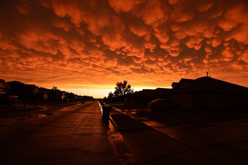
A severe thunderstorm left behind a striking sight of Mammatus clouds in Oklahoma on Wednesday, Apr. 29.
Pouches of orange clouds spread through the sky after torrential thunderstorms that brought large hail, destructive winds, heavy downpours, and even threats of tornadoes struck Oklahoma and towards the Gulf Coast.
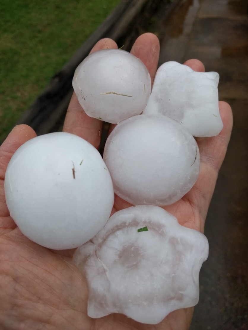
On Tuesday night, Apr. 27, the storm swept throughout Tulsa and surrounding areas while huge hail and lightning also were reported. Scott Nguyen shared via Twitter a photo of hail that went off at his parent's house. Another user replied to his tweet, saying the hale seemed like the size of a tennis ball.
The severe weather was reported on Monday. "We've had rounds of severe weather for the month of April, way ahead in terms of tornado reports," said Fox News senior meteorologist Janice Dean on "Fox & Friends".
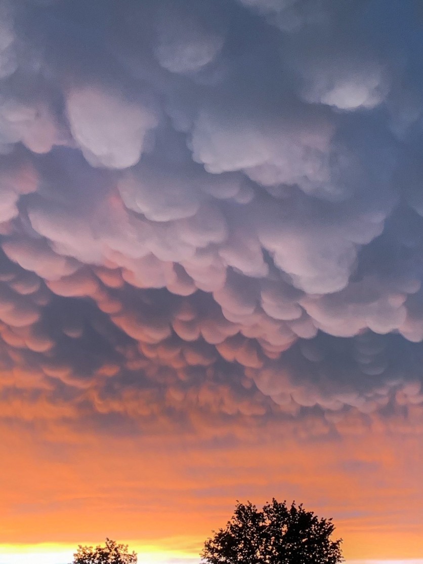
Meanwhile, heavy "mammatus clouds" could be seen in the skies after the storms left. National Oceanic and Atmospheric Administration (NOAA) described these clouds as rounded "pouch-like protrusions hanging from the undersides of clouds", named after the mammary glands.

"Mammatus clouds often accompany severe thunderstorms, but do not produce severe weather; they may accompany non-severe storms as well," explained NOAA.
WOW... Absolutely stunning #mammatus clouds over Tulsa, Oklahoma, USA yesterday evening 28th April! Video by https://t.co/TByuThppC4 #SevereWeather #okwx pic.twitter.com/rTW4PU20Im — WEATHER/ METEO WORLD (@StormchaserUKEU) April 29, 2020
The clouds are formed as a "result of air turbulence" within largely unstable cumulonimbus. This means there are high chances of hail, heavy rain, and lightning as well in the area. Also, during winter, when the air is cold enough, they can even produce snow.
Meanwhile, check out other photos of mammatus via Twitter using the hashtag #mammatus.
Severe storm threatens Gulf Coast
The Oklahoma storms have traveled southeast to the Gulf Coast. It has brought strong winds to Houston, where about 160,000 customers were left without power.
The National Weather Service (NWS) also warned residents near the Texas Gulf Coast as they may experience" potentially life-threatening conditions and rough seas."
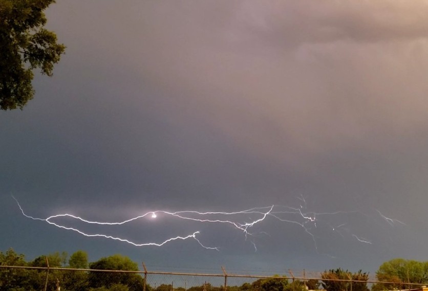
Twitter user Tonya Borden tweeted videos and photos of the storm in Houston, TX. She even took a screenshot of what seems to be a ball of lightning.
Potentially dangerous
While tornadoes are likely to happen on Wednesday, Fox News weather forecaster Dean said greater danger comes from the "straight-line wind damage" that is potentially dangerous like a tornado with gusts of over 75 mph.
As storms will redevelop on Wednesday afternoon from the Central to the Southeast Gulf Coast, serious dangers will arise from the Mid-Atlantic and Ohio River Valley.The main threat with these storms is going to be straight-line wind damage, and in some cases, that's almost as potentially dangerous as tornado damage," Dean said.
Damaging winds will also traverse in Atlanta, Charlotte, Jacksonville, Fla., and Birmingham on Wednesday. Besides, threats of heavy rainfall and flash floods also exist as rain will continue to pour towards the Northeast in the following days.
ⓒ 2026 TECHTIMES.com All rights reserved. Do not reproduce without permission.


