Google has recently expanded its AI-powered tool for tracking floods and wildfires across several locations worldwide.
The search engine giant confirms that its Flood Hub tool is currently operational in 20 countries. The feature initially underwent a pilot test in the US before making it available for iPhone and Android users.
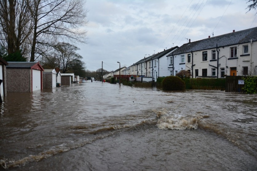
Google Expands Flood and Wildfire Forecasting AI Service
Although technological advancement when it comes to disaster tracking is becoming impressive, some parts of the world still could not properly detect weather warnings due to inadequate tools for forecasting, the UN report noted in October.
Because of this, many people are uninformed about the appropriate measures to take at times of calamities. Thus it puts their lives in danger due to a lack of lifesaving knowledge about floods, earthquakes, and other catastrophes.
According to The Verge, Google has improved its flood, and wildfire tracking tool through the Flood Hub app. Since climate change is fastly-progressing, it's about time to be equipped with proper knowledge on how to handle these sudden situations.
In 2018, the tech giant first tested this AI tool in India, particularly in the Patna region to predict the emergence of floods. Google stretched its service further in some parts of Bangladesh two years later.
Last year, Google reportedly relayed flood alerts to more than 23 million people who live in flood-prone nations. This time, this lifesaver feature is expected to reach Sri Lanka, Brazil, Colombia, South Africa, Namibia, Liberia, Angola, South Sudan, Nigeria, Malawi, Sierra Leone, Democratic Republic of the Congo, Chad, Ghana, Guinea, Ivory Coast, Burkina Faso, and Cameroon.
Related Article : Best Weather Forecasting Apps to Use For Free in iOS, Android For 2022
Smartphone Users Can Benefit From Flood Hub
Using your Android or iOS smartphone, you can now use the app to maximize its service at times when you need help, especially when we are talking about wildfires and flash floods.
Make sure to turn on your Google location service on your device so you will be notified if there are flood alerts near your area.
Of course, the tool won't work instantly and send notifications right away to smartphone users. It needs first to predict the potential location of the flood and assess the depth of the water once it strikes.
At this point, Google will make use of transfer learning through its artificial intelligence. With the new update for the Flood Hub, Google now issues flood alerts faster than before. Previously, the warnings could be released in around two days, while the new update will allow the company to issue them in just a week.
The flood-prone regions in the map bear different colors, which indicate various flood levels. Red means critical flooding areas, while teal suggests that a specific place is under normal conditions.
To look for more detailed information about the flood, you can zoom in and tap the pin, according to The Sun. Once you click it, you will start seeing different dates, warning levels, and river change forecasts.
This article is owned by Tech Times
Written by Joseph Henry
ⓒ 2026 TECHTIMES.com All rights reserved. Do not reproduce without permission.


