NASA Earth observations are being used to monitor the health impacts on veterans who were deployed to Southwest Asia in the years following the September 11, 2001 attacks.
Military personnel who served in regions like Afghanistan and Iraq were at risk of respiratory issues due to exposure to fumes, smoke, and particulate matter from burn pits, dust storms, and other sources.
Collaborating with NASA-funded researchers, the US Department of Veterans Affairs (VA) is examining the health effects of air pollution on veterans.
To achieve this, they established an online database containing NASA satellite data on air pollution around particular military bases, which will be used to identify affected veterans and support medical researchers in conducting further studies.

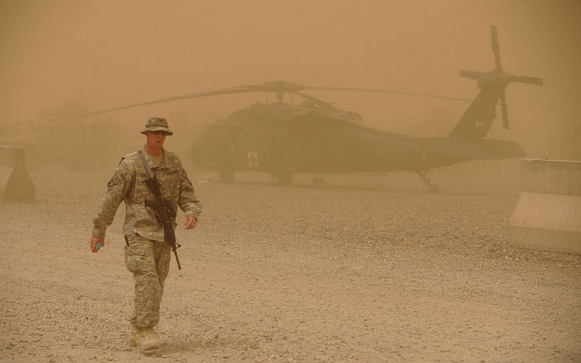
US Army soldier walks past a US Army Blackhawk helicopter from Company C, 1st Battalion, 52nd Aviation Regiment, MEDEVAC team during a sandstorm at FOB Wilson in Kandahar province in southern Afghanistan on March 27, 2011. Around 140,000 foreign troops are deployed in Afghanistan within the UN-mandated, NATO-led, International Security Assistance Force (ISAF) and the US-led coalition Operation Enduring Freedom, which overthrew the Taliban in late 2001.
Locating Sources of Pollutants
Some soldiers and support staff experienced high levels of air pollution during the Iraq and Afghanistan wars due to various sources, such as trash burning in open pits and desert dust storms.
NASA Earth science data can help to locate the sources of such pollutants. To this end, researchers have developed a web-based tool called the Source-Differentiated Air Quality System (SDAQS), which utilizes satellite observations to create an exposure assessment tool.
The SDAQS produces air quality information in a user-friendly format that allows researchers at the VA and other institutions to access it through visualizations and data downloads for each military base.
NASA's Multi-Angle Implementation of Atmospheric Correction algorithm, which obtains data on the air pollutant PM2.5 from the Moderate Imaging Spectroradiometer on Terra and Aqua satellites, is used in the SDAQS exposure assessment tool.
PM2.5 is inhalable and can penetrate deep into the lungs and respiratory tract. Researchers aim to link the exposure information obtained from NASA satellites with the deployment histories of over 5,000 veterans in a VA study.
The resource could assist in identifying lung conditions in veterans based on the types and concentrations of pollution present in their deployment areas. The work is part of a larger federal effort to improve the respiratory health tracking of veterans.
The PACT Act
This work is part of a broader federal initiative to improve the identification and monitoring of respiratory health in veterans.
The Biden administration announced in November 2021 an effort to gain a better understanding of the medical conditions experienced by troops deployed to toxic environments.
The PACT Act, a law passed by Congress, expands VA health care and benefits to veterans who were exposed to burn pits and other harmful substances. This work is an important component of this initiative.
Researchers anticipate utilizing data from the Multi-Angle Imager for Aerosols (MAIA) mission, which will launch in 2024 and is the first NASA satellite mission done in partnership with epidemiologists and health organizations.
Related Article: NASA Hubble Discovers Saturn's Ring System Heats Planet's Atmosphere-A Never-Before-Seen Phenomenon!


