A new Russia-Ukraine invasion map offers the latest updates regarding the ongoing tension between the two countries.
Right now, Russian President Vladimir Putin is already sending his troops to Ukraine. On Thursday, Feb. 24, he launched an attack against the enemy country, which led to explosions.
Knowing the latest details regarding the conflict between the two countries is essential since Putin's acts can lead to a full-scale invasion.
Because of this, CIR (Center for Information Resilience) decided to launch a new map to show the invasion's latest details.
Russia-Ukraine Invasion Map: How It Works
According to Boing Boing's latest report, the new Russia-Ukraine invasion is developed by the Center for Information, a non-profit organization that counters disinformation and influence operations.

Also Read : China's Navy Vessel Points Laser at Australia's Military Jets! Here's Why This Can Endanger Aircraft
This detail was also confirmed by CIR's Director of Investigations, Benjamin Strick.
"The mapping done by our team at @Cen4infoRes and the wider community is now verifying and logging more events inside Ukraine of shelling, bombings, and other events," said Strick via his official Twitter post.
Seeing a sad turn of events as the situation in Ukraine has escalated. The mapping done by our team at @Cen4infoRes and the wider community is now verifying and logging more events inside Ukraine of shelling, bombings and other events. Here is the link: https://t.co/QwQrTWsmBF pic.twitter.com/ZfAu4AVur6
— Benjamin Strick (@BenDoBrown) February 24, 2022
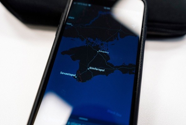
CIR's new Russia-Ukraine invasion map works by simply relying on new Twitter posts that contain videos, photos, and texts regarding the ongoing tension between the two countries.
How To Use the New Twitter Map
To use the new Russia-Ukraine invasion map of the Centre for Information and Resilience, all you need to do is search for MapHub.
You can also click this link so that you will be redirected to the official page right away. Once you are there, you will see green and yellow markings on the Ukraine map.
Once you click a mark, you will see the Twitter links that contain images and videos of the Russian invasion happening in that area.
However, you need to read the description first since some of the content provided in the link may showcase violence.
The new U.S.-Mexico border robot dogs are now being trained for deployment in other news. Meanwhile, RAF's recent warning claims that smart meters can affect the United Kingdom's EWS.
For more news updates about the ongoing Russia-Ukraine invasion and other related defense stories, always keep your tabs open here at TechTimes.
Related Article : US Missile Defense Systems Still Ineffective Against ICBMs-Even After 15 Years, Says New Study
This article is owned by TechTimes
Written by: Griffin Davis
ⓒ 2026 TECHTIMES.com All rights reserved. Do not reproduce without permission.


