Google Maps High-Definition is on its way to Polestar and Volvo electric vehicles (EVs), giving their users a more detailed navigation tool.
Polestar 3 SUV owners are the first to get their hands on the higher-resolution driving maps when it hits the roads in late 2023.

(Photo : OLIVIER DOULIERY/AFP via Getty Images)
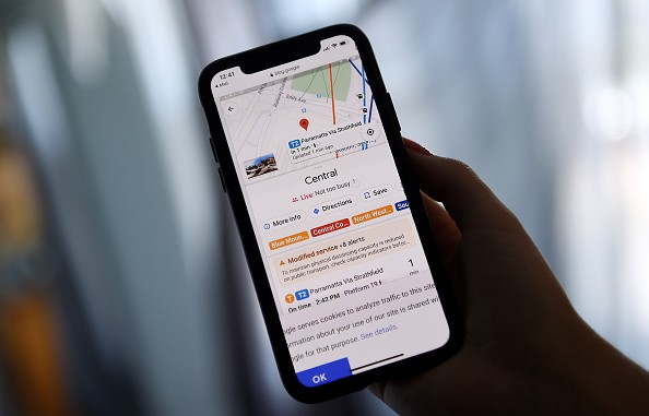
This illustration picture shows Google map application displaying popular times for transit station and how busy it is at the moment on a smartphone in Arlington, Virginia on June 9, 2020.
As such, it would take several months before the new HD version of Google Maps sees the light of day. But what can we expect from it?
Google Maps High-Definition
As per the latest story by The Verge, Google announced an all-new version of Google Maps for folks behind the wheel.
The high-definition version reportedly offers more details than what the current offering provides. So we expect to see lane markings and road signs straight from the navigational app.
Navigational apps like Google Maps have been a handy companion for drivers these days.
However, their features are quite limited to only telling the direction. They still miss out on essential information like lane markings.
But this time, the search engine giant is gearing up to release a new HD maps app for Volvo and Polestar EVs.
Coming to Volvo and Polestar EVs
According to a report by Engadget, the HD navigation map is debuting to the Polestar 3 once it arrives later this year in the United States.
Besides the Polestar EV, the higher resolution Google Maps is also on its way to the Volvo EX90 SUV.
For now, Google only announced that it is coming to Volvo and Polestar offerings. Engadget notes that the tech giant has yet to confirm if they are also planning to bring it to other car manufacturers that use Android, such as Honda, Renault, and General Motors (GM).
What to Expect
The upgraded version likely comes out later this year in time for the release of the Polestar 3.

(Photo : Justin Sullivan/Getty Images)
Members of the media watch a slideshow during a news conference about Google Maps on June 6, 2012 in San Francisco, California.
HD Maps provides more data thanks to the sensors of vehicles, including cameras, lidar, and radar. These sensors also aid the driver-assist features of these EVs.
The Vice President and General Manager of GEO Automotive at Google, Jørgen Behrens, explained what the HD map brings to the table.
The tech exec says "Google's new HD map is designed specifically for automakers and provides comprehensive lane-level and localization data that is crucial to powering the next generation of assisted and autonomous driving systems."
Behrens also touted that the new feature should help "improve the safety and comfort of drivers everywhere."
Engadget notes in its report that the new HD maps not only help drivers better navigate their routes. Instead, it could potentially assist the self-driving features of these vehicles.
Related Article: Google is Attempting to Merge Teams From Maps, Waze as Part of Cost-Cutting Operation


