NASA took satellite images of the California Wildfires at night and it found heatwaves formed within the raged area.
California has been raged by at least 350 wildfires across the central and northern parts of the state after more than 7,000 lightning struck on Aug. 18. These fires have triggered a sustained heatwave that formed a "heat dome" across the state.
Over 48,000 people have already been evacuated due to the current wildfire situation that was a combination of extended heat waves, dry forest conditions, and unusual August storms. Aside from novel coronavirus, residents now wear face masks at all times to shield themselves from the effects of the thick smoke that has covered much of the state.
Also, NASA noted that some of these fires are too large to "create" their own weather systems as hot air rises that generates an updraft. When the air ascends, condenses the air into water droplets on the ash and moisture in the upper atmosphere cool also go up and they form together a cloud called a pyrocumulus or "fire cloud."
Meanwhile, a huge fire can generate a pyrocumulonimbus cloud. Aside from being a fire cloud, pyrocumulonimbus is also a firestorm cloud that can form lightning and winds, which would be more disastrous as it would prolong the cycle and trigger more fires. Worse, these fires can also trigger tornadoes or "fire tornadoes" when the movement of the air or the updrafts occur so fast and creates a whirling effect.
Satellite images show California Wildfires at night
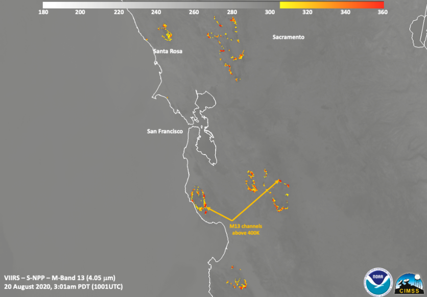
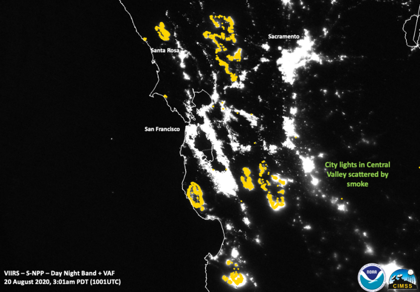
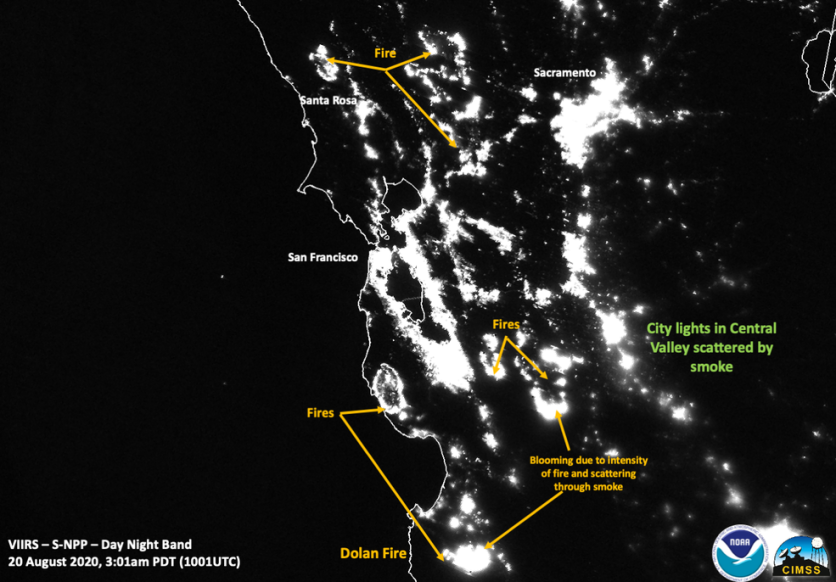
NASA's Suomi NPP satellite took stunning images of the California wildfires at night on August 20. At approximately 3:01 am PDT, the satellite was almost directly overhead the raged area when it took an image of the state using its Visible Infrared Imaging Radiometer Suite (VIIRS) instrument. The image shows the large fires as well as lights in the Central Valley that were being scattered by the smoke.
NASA has numerous Earth-observing instruments, which has provided information vital to understanding fires in the Earth. These instruments detect actively burning fires, track their smoke, provide information for fire management, and map the effects of these fires to ecosystems.
Satellites orbiting the poles provide daily observations of the entire planet while those satellites in a geostationary orbit update every five to 15 minutes, providing coarse-resolution imagery of fires, clouds, and smoke. NASA's satellite instruments usually detect wildfires in remote regions first then the agency sends the locations to land managers worldwide within hours through the satellite overpass.
The recent California wildfires were started due to lightning strikes. The amount of lightning that occurred over three and a half days is equivalent to 9% of the amount California experiences in a year. Some of the lightings have merged to form major complexes of fires, including the two largest complexes: the Lake Napa Unit (LNU) Lightning Complex and the Santa Clara Unit (SCU) Lightning Complex.
Currently, the LNU Complex of fire is made up of seven fires triggered by lightning that struck the Napa Valley Area. It has raged 215,000 acres with 0% containment. The LNU fire complex is now the ninth largest fire in the history of California. Meanwhile, the SCU complex is a combination of over 20 fires and has already covered 157,475 acres located near Santa Clara. It is being managed by the Santa Clara fire unit, which has already contained 5% of the fire.
This is owned by Tech Times.
Written by CJ Robles
ⓒ 2026 TECHTIMES.com All rights reserved. Do not reproduce without permission.


