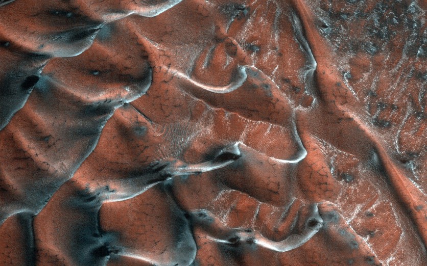
NASA's Mars Reconnaissance Orbiter (MRO) beamed back another photo taken at the red surface, this time showing the stunning image of the frosty sand dunes.
The astonishing image earned its place at NASA's Image of the Day and was featured on Thursday, Mar. 25.
Discovering the Frosty Sand Dunes
The Jet Propulsion Laboratory (JPL), a division of Caltech in Pasadena, California, assigned to manage the MRO Project for NASA, first shared the image of the frosty sand dunes on their website on Mar. 22.
According to their post, the field of sand dunes was occupying a frosty crater that stretches for 5 kilometers, found in the high-latitudes of Mars' northern plains.
A series of dark-toned polygonal patterns layers the surface of the primary dune field, which is believed to be the result of seasonal frost processes.
"These may be the result of seasonal frost processes. Several of the steeper dune slopes, pointing in the downwind direction, host narrow furrows suggesting the start of gully formation," the post described.
The post also described that the crater floor is lined with various textures such as lobate and striped patterns indicating that sublimating ice had caused its seasonal thaw.
HiRISE: The All-Seeing Eye of the Mars Orbiter
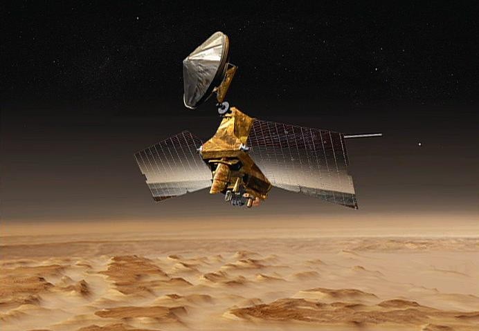
According to an article by Digital Trends, which was posted on Thursday, Mar. 25, the breathtaking image was captured by the Orbiter's High-Resolution Imaging Science Experiment (HiRISE) camera that hovers over the red planet from an altitude of 196 miles (315 km).
The camera, which had captured hundreds of stills of Mars' surface, was designed so that its telescopic lens operates in visible wavelengths, allowing it to capture images in unprecedented detail.
It is imperative for the Mars Orbiter to produce incredibly high-resolution images, as these will allow researchers to distinguish objects on Mars and comprehensively study its surface structure.
Operating from an altitude between 200 to 400 kilometers (about 125 to 250 miles) above Mars, HiRISE captures images of the red planet's surface that contains "individual, basketball-size (30 to 60 centimeters, or 1 to 2 feet wide) pixels," which provides unprecedented views of layered materials.
Armed with six instruments capable of studying Mars' topography from underground layers to the top of the atmosphere, the Mars Orbiter arrived on the red planet in 2006.
Its main goal is to search for evidence that water once flourished on the planet's surface for long periods and to discover if water had been on the planet long enough to sustain life.
The Mars' Orbiter also beamed a photo of a layer of clean ice that lies below the surface of "Martian scallops."
According to a post published by the Mars Exploration Program page on Mar. 22, as these layers of eroded ice, leave a hole where surface dust collapses, forming into a "scallop" over time.
Related Article: NASA Mars Probe Completes 50000th Red Planet Orbit
This article is owned by Tech Times
Written by Lee Mercado
ⓒ 2026 TECHTIMES.com All rights reserved. Do not reproduce without permission.


