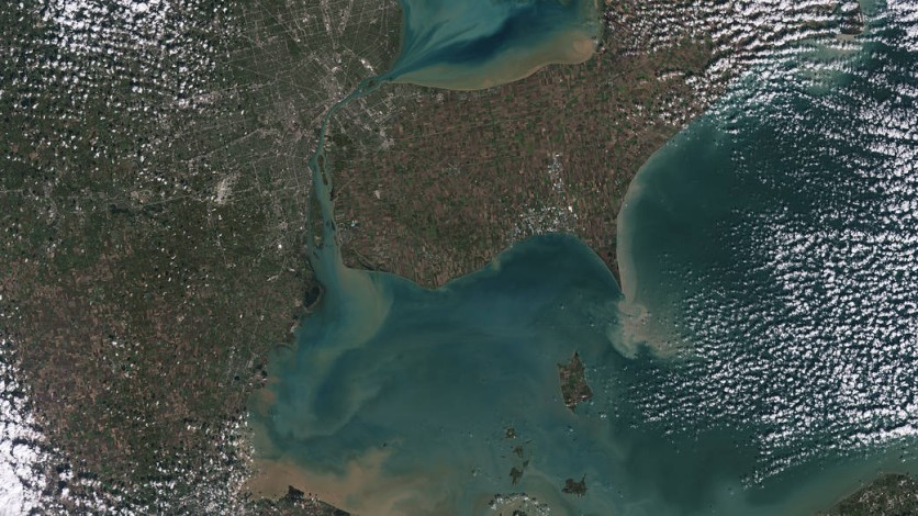
NASA and the United States Geological Services' Landsat-9 has sent over the first images that the satellite has gathered, and it is with the planet's stature, particularly with the ongoing climate crisis. The space agency will use these photos to help and understand the current state of the plant's climate and use its data to know the further steps needed to be taken in solving the problem.
NASA, USGS Landsat-9 First Images

NASA and the USGS have released the first images of the Landsat-9 which is available on the website of the space agency, showing what the satellite has seen in its early days. The satellite shows different parts of the world, focusing its cameras and other equipment to specific locations that NASA and the USGS have chosen to monitor.
The Landsat-9 brings a new perspective in seeing more of the planet, something that provides a different point-of-view on a larger scale compared to aerial photos. The photos are available for viewing online, and here people can see the current state of Earth's geological structure and more.
Currently, these images are also under study from researchers and scientists that are with NASA and the USGS, as well as it being open for public viewing.
Landsat-9 Sees Climate Crisis
There is a Climate Crisis that the world is fighting right now, and it is with the grueling effects of the many changes now. Global warming and pollution are several of its effects or causes, harming the environment and its daily processes.
The Landsat is here to oversee this and help researchers learn more about the necessary steps to be taken.
NASA's Climate Projects
Most satellites that are staying or roaming around the low-Earth orbit are known to have their location be strategic so that they could see more o space and stay above the clouds and other potential hindrances. This is what the Hubble Space Telescope is located, as well as different satellites and telescopes that monitor deep space.
However, space crafts that are located in the LEO are not for seeing the deep space only, as it could also monitor the planet with the likes of the Landsat program that is meant for monitoring Earth. Of course, this is one of the most important focuses of the space agency, as it is where humans live and reside, something that needs care and assistance.
Currently, the climate crisis is worsening, and this is amidst the many clean energy and eco-friendly solutions that have been launched in the past years that aim to help this problem. However, it would take a long time and the full cooperation of everyone that lives on Earth to help in this crisis, as it could potentially make the race extinct.
Related Article : NASA Hubble Telescope in Safe Mode AGAIN | Space Agency Investigates Multiple Error Codes
This article is owned by Tech Times
Written by Isaiah Richard
ⓒ 2026 TECHTIMES.com All rights reserved. Do not reproduce without permission.


